Welcome DJI Spark Pilot!
Jump in and join our free Spark community today!
Sign up

Thinking about buying a spark - basic question about how high it can fly

kushner.sound

New Member
Join
Jun 2, 2019
Messages
1
Age
40
Hello. I'm thinking about buying a Spark and I'm curious how high up it can go. I see on the website specs that under "vision system" it lists altitude range of 0-26 feet. Does that mean that you can only fly it 26 feet into the air? Also confirming that you can position the camera straight down towards the ground.

For some background info, I work as a landscape designer and I'm looking to purchase a drone to help take pictures to survey sites, and then import these pictures into my cad program to figure out square footage, work on design, etc.

Thanks so much.
 
  • Like
Reactions: Andre Levite
500 meters is the limit for height. I have gone as far as1.5 miles away . It will do 30 mph in sport mode . Camera will go from straight ahead to straight down . You can set a button for a shortcut to a favourite option that you want to use often .
Hope this helps ya
 
In the USA legally you can't go over 400 ft per FAA. I never fly my Spark over 400 Ft high but I have flown it up to 396 ft and where I live I lose signal at about 3/4's of a mile in distance.
 
  • Like
Reactions: RichPinecone
We had a 300’ limit in Canada but now it has bumped up to 400 ‘ just like the USA
 
  • Like
Reactions: Vader01
Hello. I'm thinking about buying a Spark and I'm curious how high up it can go. I see on the website specs that under "vision system" it lists altitude range of 0-26 feet. Does that mean that you can only fly it 26 feet into the air? Also confirming that you can position the camera straight down towards the ground.

For some background info, I work as a landscape designer and I'm looking to purchase a drone to help take pictures to survey sites, and then import these pictures into my cad program to figure out square footage, work on design, etc.

Thanks so much.

The camera cannot point exactly straight down (90 degrees). It is limited to 85 degrees. That should still be okay for the use you are describing

10277

The Vision System is used to confirm the Home Point optically and for hovering in place while indoors. It does not limit the Sparks altitude -- it just can't "see" once you're above 26'.

FAA regulations limit altitude to 400' above ground level although the Spark can reach much higher (1640'). The maximum operating altitude is 13,123' above sea level.

Hope that helps
 
Last edited:
Hello. I'm thinking about buying a Spark and I'm curious how high up it can go. I see on the website specs that under "vision system" it lists altitude range of 0-26 feet. Does that mean that you can only fly it 26 feet into the air? Also confirming that you can position the camera straight down towards the ground.

For some background info, I work as a landscape designer and I'm looking to purchase a drone to help take pictures to survey sites, and then import these pictures into my cad program to figure out square footage, work on design, etc.

Thanks so much.

The DJI app allows you to go as high as 500m but drone pilots have to abide by drone regulations in various countries which are much stricter regarding altitude limit. Just to give you a couple of examples, you are not allowed to fly 400 ft. above ground level in the USA and not above 150m in Japan.
Now regarding the specific application you are looking for, you cannot point the camera exactly 'straight down'. The max. you can go is 85 degrees but I think you can still get the results you are looking for. Please take a look at the attached image. It is a stitched image from 16 separate images taken with the Spark.
 

Attachments

  • DJI_3017_stitch.jpg
    8.9 MB · Views: 107
  • Like
Reactions: Vader01 and Haggi
Correction to post #2
All good info except the camera can point above straight ahead.
Switch into tripod mode and you can point up high enough to make the horizon disappear.

I use this feature for sunrises & sunsets.
The ground landscape is dark anyway so....10282
 
I flew my spark over 760ft straight up(I was in the middle of nowhere and no flight paths overhead)... But you should never do that unless you are taking pictures of a 400ft tall building and make sure that your not violating any airspace...
 
  • Like
Reactions: Vader01
I'm in Africa with no restrictions. I want to send it 500m up, but I'm afraid of losing contact, battery running out, a fly-away, etc. What should I do to ensure that it comes back safely down where I launch from?
 
I'm in Africa with no restrictions. I want to send it 500m up, but I'm afraid of losing contact, battery running out, a fly-away, etc. What should I do to ensure that it comes back safely down where I launch from?
Get familiar with apps that give you weather and wind conditions, like UAV Forecast, Windy.com, these will give you your best shot at when to try. Also, consider using flightradar24.com and its app, (all these are websites with matching apps) to view the airtraffic in your chosen location. At 500m you are hitting commercial air lanes. Are there local airports, small airfields? Check Skyvector.com also. Use a battery strap. Wanting to go up so high is fine as long as you are not going to bring something larger down. The #1 thing you should consider is safety.
 
  • Like
Reactions: twickers14
I'm in Africa with no restrictions. I want to send it 500m up, but I'm afraid of losing contact, battery running out, a fly-away, etc. What should I do to ensure that it comes back safely down where I launch from?
When you are going that far up, make sure you have the Attitude indicator ON instead of the map on the lower left corner. The wind speeds vary quite a bit with the increase in altitude and the attitude indicator is your best guide to tell you the condition of the AC.
 
Not to be a party pooper but if you use a drone in your Landscape business you are aware that you will need a 107 license. Other than that the Spark will be great for that
 
Get familiar with apps that give you weather and wind conditions, like UAV Forecast, Windy.com, these will give you your best shot at when to try. Also, consider using flightradar24.com and its app, (all these are websites with matching apps) to view the airtraffic in your chosen location. At 500m you are hitting commercial air lanes. Are there local airports, small airfields? Check Skyvector.com also. Use a battery strap. Wanting to go up so high is fine as long as you are not going to bring something larger down. The #1 thing you should consider is safety.
Thank you
 
Not to be a party pooper but if you use a drone in your Landscape business you are aware that you will need a 107 license. Other than that the Spark will be great for that
Yep, in the US its "in furtherance of a business"... big fines if you dont 107... skip to 2:30 in this video for some clarity. (or watch the whole thing cuz Ken is cool....)

 
It goes as high as legally allowable in the airspace you are flying in. ;)

in Denmark that is 100m AGL non-urban, 120m AGL urban, except when within 2km of airports, then it's 40m AGL
in Romania that is 300m AGL (or was when I flew there in December 2018) in cleared airspace not near airports.

(for example) :D
 
I'm in Africa with no restrictions. I want to send it 500m up, but I'm afraid of losing contact, battery running out, a fly-away, etc. What should I do to ensure that it comes back safely down where I launch from?

As long as you have clear line of sight and it's not too windy, and you calibrated your drone correctly before flight, you should not have any trouble. But do not fool yourself that there are 'no restrictions' in Africa!

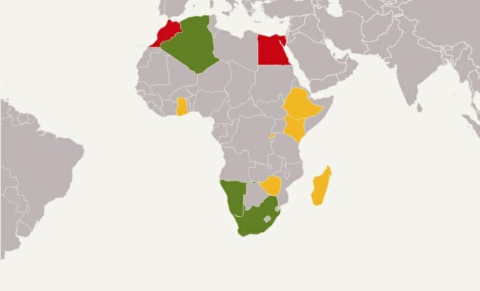
Some countries do have restrictions in Africa. For example you can’t fly over national parks. Nairobi will take your drone on arrival at the airport and give it back when you leave (if you fill out the appropriate paperwork of course), and Ethiopia requires a permit - for example.

Dronemade | Drone Rules - World Map (rules listed by country are farther down the page)
 
I'm in Africa with no restrictions. I want to send it 500m up, but I'm afraid of losing contact, battery running out, a fly-away, etc. What should I do to ensure that it comes back safely down where I launch from?
Get familiar with apps that give you weather and wind conditions, like UAV Forecast, Windy.com, these will give you your best shot at when to try. Also, consider using flightradar24.com and its app, (all these are websites with matching apps) to view the airtraffic in your chosen location. At 500m you are hitting commercial air lanes. Are there local airports, small airfields? Check Skyvector.com also. Use a battery strap. Wanting to go up so high is fine as long as you are not going to bring something larger down. The #1 thing you should consider is safety.

Another good weather resource is Ventusky - Weather Forecast Maps via this website (free), and there is an app (small cost).
You can view wind speed (and many other weather options) at various altitudes via the menu, also forecasts using the date / time bar at the bottom.

I work as a landscape designer and I'm looking to purchase a drone to help take pictures to survey sites, and then import these pictures into my cad program to figure out square footage, work on design, etc.

There are a few low or no cost apps you can use that are made for 2D and 3D mapping like this.
Check out Pix 4D and Drone Deploy, not sure if Spark is supported on both (mostly my experience is Mavic), but I do know I read of one (perhaps other) app that does this with Spark.
 
  • Like
Reactions: digitalmouse
  • Like
Reactions: SPark_South_Oz

New Posts

Members online

No members online now.

Forum statistics

Threads
14,600
Messages
118,822
Members
18,009
Latest member
Manzoorsp67