- Join
- Dec 14, 2017
- Messages
- 72
- Age
- 53
HI
I own a Spark which is registered with the italian aviation commission in order to be able to fly also in urban areas. To date, other rthan flying for hobby I just did some roof inspections and videos of some local events, just gigs "paid" with drinks at the pub, a couple of dinners at a festival or a wheel of pecorino cheese")
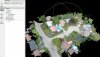
Now I talked with two persons in the building industry and both told me that if I could provide them with 3D models of building places and/or existing buildings it could be very interesting for them, and that they would pay money, not just scraps.
Before spending money on a software which I may be using for just one or two jobs, is there something free out there? I use an Android phone, so for the drone part I was thinking to Red Waypoints or Litchy, which cost really little, but for the software which should acquire the photos and build the 3D model or point cloud it looks like there's nothing free. Am I missing something?
I own a Spark which is registered with the italian aviation commission in order to be able to fly also in urban areas. To date, other rthan flying for hobby I just did some roof inspections and videos of some local events, just gigs "paid" with drinks at the pub, a couple of dinners at a festival or a wheel of pecorino cheese
Now I talked with two persons in the building industry and both told me that if I could provide them with 3D models of building places and/or existing buildings it could be very interesting for them, and that they would pay money, not just scraps.
Before spending money on a software which I may be using for just one or two jobs, is there something free out there? I use an Android phone, so for the drone part I was thinking to Red Waypoints or Litchy, which cost really little, but for the software which should acquire the photos and build the 3D model or point cloud it looks like there's nothing free. Am I missing something?