
Hi all... so I have started to do more of these with the MA2, went flying today and got off the farm for a change.
Feel free to have a look at my growing collection of 360s.
Today I drove down the Trans Canada highway a ways, and stopped near Deux-Rivieres, which is where the Brent road is located, and 28km down that road is the Brent Crater and Algonquin Park's other north entrance. I did not enter the park, but did fly by a nice lake, video coming next week.
Later I stopped down a logging road and captured this 360 along with the flight video, that will come next week. For those unfamiliar, the Ottawa River is one of the dividing boundaries between Canada's two most populace provinces, Ontario and Quebec. However, not too many people around here, except passing through in cars, and one lone boat out on the river. Was a beautiful day for flying. Here's the link, you can zoom in and out with your mouse...
 kuula.co
I also snagged a still image whilst there, as below...

Take care all.
Feel free to have a look at my growing collection of 360s.
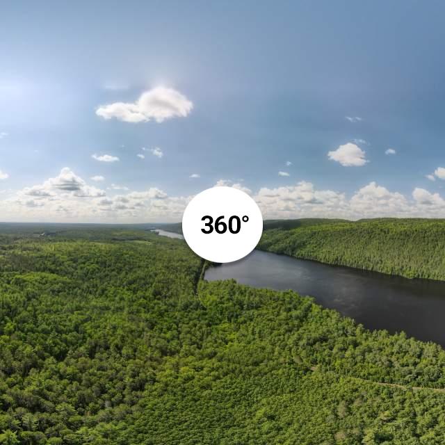
Today I drove down the Trans Canada highway a ways, and stopped near Deux-Rivieres, which is where the Brent road is located, and 28km down that road is the Brent Crater and Algonquin Park's other north entrance. I did not enter the park, but did fly by a nice lake, video coming next week.
Later I stopped down a logging road and captured this 360 along with the flight video, that will come next week. For those unfamiliar, the Ottawa River is one of the dividing boundaries between Canada's two most populace provinces, Ontario and Quebec. However, not too many people around here, except passing through in cars, and one lone boat out on the river. Was a beautiful day for flying. Here's the link, you can zoom in and out with your mouse...
Ottawa River Pano
Virtual Tour | Just a little north of Deux-Rivieres, point of view on the Ontario side.
kuula.co
I also snagged a still image whilst there, as below...
Take care all.
Last edited:


")