- Join
- Oct 8, 2017
- Messages
- 13
- Age
- 47
Hello,
First short introduction, i am brand new drone pilot, spark is my first ever drone i have owned and flied. First I was planning Mavic but though better start easier and upgrade later. I have had spark now about two weeks and keep learning and flying. Trying different setting everytime, recording and checking how it looks like.
Yesterday I was testing active tracking and trying to launch it first from palm and activate only using phone (usually Im always using RC) I initiate but kept getting error message aircraft too low even the drone was about 2-3 meters high (got distracted and forgot to check what display showed on screen) so I kept launching it while getting error message aircraft too low. Eventually I put it bit higher and got it to work (again unfortunately I did not read altitude on screen...)
After that I connected RC so easier controlling. I flew awhile and lifted drone about 30 meter and suddently RTH launched and could not move drone at all. It started to rapidly decent, got bit panicked. I was pressing pause on RC, pressing cancel on screen even hold RTH button on RC, trying to move sticks. Eventually pushing left stick forward got it stop. I was thinking hmmm what was that. I took drone down, changed battery and calibrated GPS and started to fly. Same thing happened when i got up past 30 meters. At that point I packed drone and called for the day. When I got back home I though IMU calibrate was needed so I did it.
Today I planned practise manual ISO, shutter speed and WB setting while manoeuvring tripod mode at low altitude (2-4 metres) Spark was acting perfectly, accurate and hovering very still (again did not check altitude on screen...) After a while I though I would do slow clime front of tree above treeline. Again around 30 metre mark RTH initiated. This time I did not panicked and eventually gain control of the plain. After I got plain safely back on my hand I went back home.
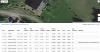
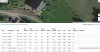
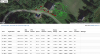
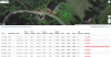
At home I connected my iphone to macbook so I could screen record. At provided video does not show GPS calibration but I did it before take off. I took drone off first to 30 meters and noticed altitude was not accurate, nothing happened. I took plain bit higher and according reading after 40 meter RTH came on. It was not even moving down. I should have speak while recording because I forgot sequence of pressed button.
I think first I pressed RC pause button-- nothing happened, then I pressed onscreen cancel---nothing then long press to RTH button on RC- nothing. Left stick up or down nothing but I was able to rotate as seen on video. After long pull left button aircraft started rapid decent. Pushing forward the left stick I got it to stop and safely on the ground.
Beginning the video i am showing my setting so you can check it if any of them are causing this. I appreacited any of your help if you need something else I will provide. I also like to thank many of you in this forum, I have learned a lot last 2 weeks in here.
app version 4.1.12
aircraft version 01.00.0600
flight database version 01.00.01.07
basic app fly safe database version 01.00.01.05
precise app fly safe database version 01.00.01.07
First short introduction, i am brand new drone pilot, spark is my first ever drone i have owned and flied. First I was planning Mavic but though better start easier and upgrade later. I have had spark now about two weeks and keep learning and flying. Trying different setting everytime, recording and checking how it looks like.
Yesterday I was testing active tracking and trying to launch it first from palm and activate only using phone (usually Im always using RC) I initiate but kept getting error message aircraft too low even the drone was about 2-3 meters high (got distracted and forgot to check what display showed on screen) so I kept launching it while getting error message aircraft too low. Eventually I put it bit higher and got it to work (again unfortunately I did not read altitude on screen...)
After that I connected RC so easier controlling. I flew awhile and lifted drone about 30 meter and suddently RTH launched and could not move drone at all. It started to rapidly decent, got bit panicked. I was pressing pause on RC, pressing cancel on screen even hold RTH button on RC, trying to move sticks. Eventually pushing left stick forward got it stop. I was thinking hmmm what was that. I took drone down, changed battery and calibrated GPS and started to fly. Same thing happened when i got up past 30 meters. At that point I packed drone and called for the day. When I got back home I though IMU calibrate was needed so I did it.
Today I planned practise manual ISO, shutter speed and WB setting while manoeuvring tripod mode at low altitude (2-4 metres) Spark was acting perfectly, accurate and hovering very still (again did not check altitude on screen...) After a while I though I would do slow clime front of tree above treeline. Again around 30 metre mark RTH initiated. This time I did not panicked and eventually gain control of the plain. After I got plain safely back on my hand I went back home.
At home I connected my iphone to macbook so I could screen record. At provided video does not show GPS calibration but I did it before take off. I took drone off first to 30 meters and noticed altitude was not accurate, nothing happened. I took plain bit higher and according reading after 40 meter RTH came on. It was not even moving down. I should have speak while recording because I forgot sequence of pressed button.
I think first I pressed RC pause button-- nothing happened, then I pressed onscreen cancel---nothing then long press to RTH button on RC- nothing. Left stick up or down nothing but I was able to rotate as seen on video. After long pull left button aircraft started rapid decent. Pushing forward the left stick I got it to stop and safely on the ground.
Beginning the video i am showing my setting so you can check it if any of them are causing this. I appreacited any of your help if you need something else I will provide. I also like to thank many of you in this forum, I have learned a lot last 2 weeks in here.
app version 4.1.12
aircraft version 01.00.0600
flight database version 01.00.01.07
basic app fly safe database version 01.00.01.05
precise app fly safe database version 01.00.01.07
") well learn that now.
well learn that now.